

1888 Narragansett Bay Map
$248.00
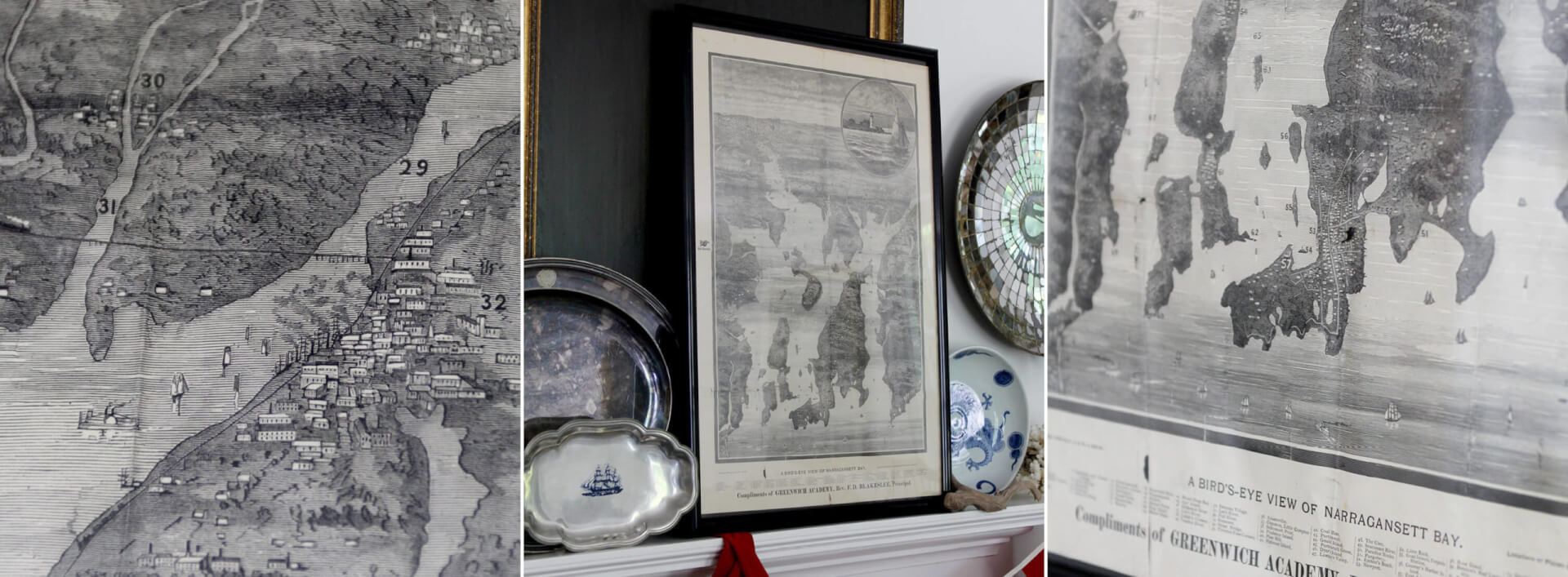
A 133 year old POV. This stunning antique map of Rhode Island’s waterways, islands, towns and cities in 1888 is just so interesting and quite unique. It’s titled “A Bird’s Eye View Of Narragansett Bay, copyrighted in 1888 by J.A. & R.A. Reid. The map is numbered #1 – #84, and starts with Providence in the far distance to the Narragansett Pier and its tiny Clipper Ships and Sailboats at the bottom. A view of a lighthouse with a full masted sailboat is featured in the upper right “bubble”. Just such a rare find.
31”H x 21”W
Antique paper map, black frame
A Bird’s Eye View of Narragansett Bay, 1888 by J.A. & R.A.Reid
Antique
Beautiful and age appropriate condition
Only 1 available
Out of stock